LRIS GOA
Offentlige myndigheder
info
5 t+
Downloads

PEGI 3
info
Om denne app
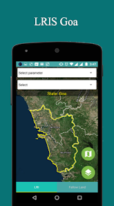
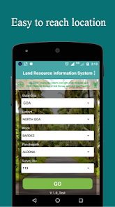
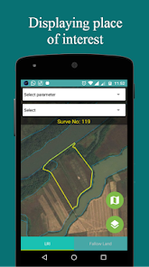
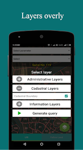
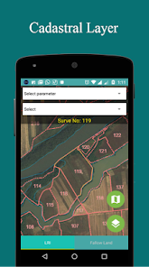
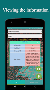
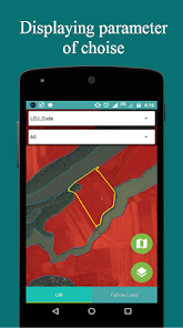
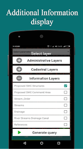
Lris Goa (Land Resource Information System) er Android-baserede mobil applikation. Dette er et GIS (Geologisk informationssystem) basis applikation, der bruger ESRI kort der virker for kun goa tilstand. Denne applikation giver den grafiske oplysninger i goa stat og viser også flere lag State Boundary, District Boundary, Taluka Boundary, Panchayat Boundary og matrikulære grænse.
Opdateret
For at du kan beskytte dine data, er det vigtigt at sætte sig ind i, hvordan udviklere indsamler og deler disse data. Databeskyttelses- og sikkerhedsprocedurer kan variere afhængigt af din brug, din region og din alder. Udvikleren har leveret disse oplysninger og kan løbende opdatere dem.

Der deles ikke data med tredjeparter
Få flere oplysninger om, hvordan udviklere angiver, at de deler data

Der blev ikke indsamlet data
Få flere oplysninger om, hvordan udviklere angiver, at de indsamler data
Nyheder
Bug fix


