Coastal and Marine Geospatial Technologies
D.R. Green
2010年3月 · Coastal Systems and Continental Margins 第 13 本图书 · Springer Science & Business Media
2.0star
2条评价report
电子书
451
页
report评分和评价未经验证 了解详情
关于此电子书
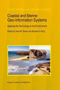
In 2005 the CoastGIS symposium and exhibition was once again held in Aberdeen, Scotland, in the UK, the second time that we have had the privilege host this international event in the city of Aberdeen. This was the 6th International S- posium Computer Mapping and GIS for Coastal Zone Management, a collabo- tion between the International Cartographic Association’s (ICA) Commission on Marine Cartography, and the International Geographical Union’s (IGU) Comm- sion on Coastal Systems. The theme for 2005 was: De ning and Building a Marine and Coastal Spatial Data Infrastructure. As a major coastal event, the CoastGIS series of conferences always attracts an international audience of coastal researchers, managers, and pr- titioners who use one or more of the geospatial technologies (e. g. GIS, GPS, digital mapping, remote sensing, databases, and the Internet) in their work. The CoastGIS series is fundamentally an international event which over the years has gained a strong following attracting delegates from around the globe. Hosted by the University of Aberdeen – at the Aberdeen Exhibition and Conference Centre (AECC) – once again CoastGIS 2005 provided an opportunity to communicate the results of a wide range of innovative scienti c research into coastal and marine applications of the geospatial technologies, including remote sensing, Geograp- cal Information Systems (GIS), Global Positioning Systems (GPS), databases, data models, the Internet and online mapping systems.
评分和评价
2.0
2条评价
为此电子书评分
欢迎向我们提供反馈意见。
如何阅读
智能手机和平板电脑
笔记本电脑和台式机
您可以使用计算机的网络浏览器聆听您在 Google Play 购买的有声读物。
电子阅读器和其他设备
如果要在 Kobo 电子阅读器等电子墨水屏设备上阅读,您需要下载一个文件,并将其传输到相应设备上。若要将文件传输到受支持的电子阅读器上,请按帮助中心内的详细说明操作。